These are illustrations taken from yesterday’s CAD MODIS file.
First, what used to be the ‘safe pack’ N of the CAA. The sign of safety used to be the well structured ‘mesh-pattern’ of leads and floes. The rhomboid/trapezium shaped floes used to have a median surface of about a 1000 km2 at the end of winter and usually a SE-NW line-up. These properties lasted all through summer in a large part of the CAB. Until 2012. Since then, the ‘safe pack’ diminued in size, down to 1.8 and even 1.2 Mkm2. And its’structure decomposed as the trapezoid floes got to median sizes of less then 100 km2.
Yesterday this was the situation:
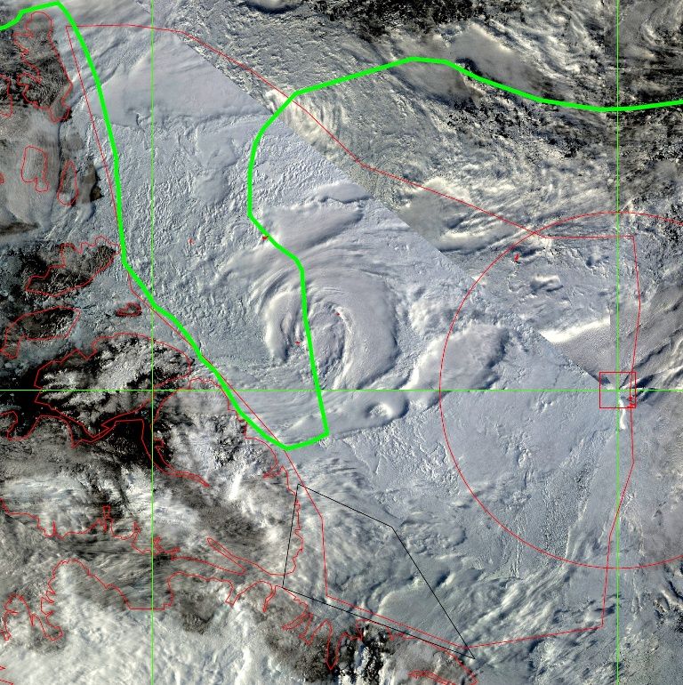
What’s left of a ‘safe pack’ is around 1Mkm2 in size. It has hardly any structure.
(The red line marks this 1Mkim2 area. The green line is the margin of low concentration ice in August '15)
As I wrote in August ’13: “…In it’s original form, the pack is/was meshed into trapezium shaped areas, averaging about 1000 km2, by stress leads. They start to widen as the pack gets more mobile, prone to, FI, tides. The ridging on their sides gets weaker, starts filling the leads with debris. Mechanical forces fracturize this further and eventually starts decomposing the large trapezia into smaller floes, following the secondary cracks that were already present. What happens is not just melting but structural weakening…”
Tonight I wrote: “…a growing zone where the loose floes are getting torn apart ever further. Reaching to the Atlantic Front from the back side…”:
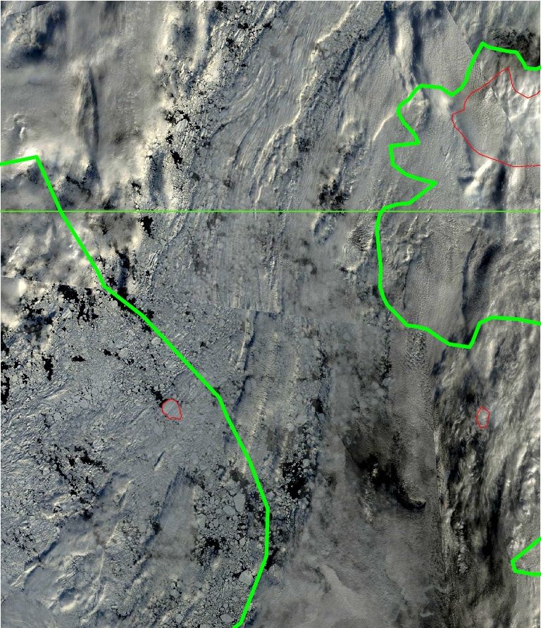
A part of the band of floes N of Frantsa Yosefa/Severnaya Zemlya.
It’s what was also picked up by JDAllen. This is no cohesive pack. There’s just a 137 km stretch of loose floes between open water stretches. It could easily open up given the right conditions.


