Support the Arctic Sea Ice Forum and Blog

Author Topic: ICESat-2  (Read 3153 times)

Jim Hunt

  • First-year ice
  • Posts: 6268
  • Don't Vote NatC or PopCon, Save Lives!
    • View Profile
    • The Arctic sea ice Great White Con
  • Liked: 893
  • Likes Given: 87
ICESat-2
« on: April 15, 2016, 01:10:12 PM »
ICESat-2 now has its very own web site

Quote
ICESat-2 will provide scientists with height measurements that create a global portrait of Earth’s 3rd dimension, gathering data that can precisely track changes of terrain including glaciers, sea ice, forests and more.

While many of ICESat-2’s discoveries are yet to be imagined, the satellite mission has four science objectives:

  • Measure melting ice sheets and investigate how this effects sea level rise,
  • Measure and investigate changes in the mass of ice sheets and glaciers,
  • Estimate and study sea ice thickness,
Measure the height of vegetation in forests and other ecosystems worldwide.[/li]
[/list]
"The most revolutionary thing one can do always is to proclaim loudly what is happening" - Rosa Luxemburg

ivica

  • Nilas ice
  • Posts: 1492
  • Kelele
    • View Profile
  • Liked: 99
  • Likes Given: 0
Re: ICESat-2
« Reply #1 on: February 12, 2018, 09:11:41 PM »
(I'm not aware of thread dedicated to satellites... so hopefully Jim will let me use this one.)

EGU Blogs » Divisions » Cryospheric Sciences » Image of the Week – The Gap, the Bridge, and the Game-changer


Quote
The Gap, the Bridge, and the Game-changer are three series of satellites. They carry instruments that measure the microwave radiation emitted by the Earth (called passive microwave instruments), while flying 800 km above our heads at 7,5 km/s. Since the late 1970s, most sea ice properties (concentration, extent, area, velocity, age and more!) have been measured with such passive microwave instruments.
So who are the Gap, the Bridge, and the Game-changer? Their story is what this Image of the Week is about…
« Last Edit: February 12, 2018, 09:22:08 PM by ivica »

vox_mundi

  • Multi-year ice
  • Posts: 10233
    • View Profile
  • Liked: 3517
  • Likes Given: 754
Re: ICESat-2
« Reply #2 on: April 17, 2023, 07:21:44 PM »
NASA ICESat-2 Satellite's Elusive Green Lasers Spotted at Work
https://phys.org/news/2023-04-nasa-satellite-elusive-green-lasers.html

... It's the first time the ICESat-2 team has seen footage of the satellite's green laser beams streaming from orbit to Earth, said Tony Martino, ICESat-2 instrument scientist at NASA's Goddard Space Flight Center in Greenbelt, Maryland.


... ICESat-2 was launched in September 2018 with a mission to use laser light to measure the height of Earth's ice, water, and land surfaces from space. The laser instrument, called a lidar, fires 10,000 times a second, sending six beams of light to Earth. It precisely times how long it takes individual photons to bounce off the surface and return to the satellite. Computer programs use these measurements to calculate ice losses from Greenland and Antarctica, observe how much of the polar oceans are frozen, determine the heights of freshwater reservoirs, map shallow coastal regions, and more.
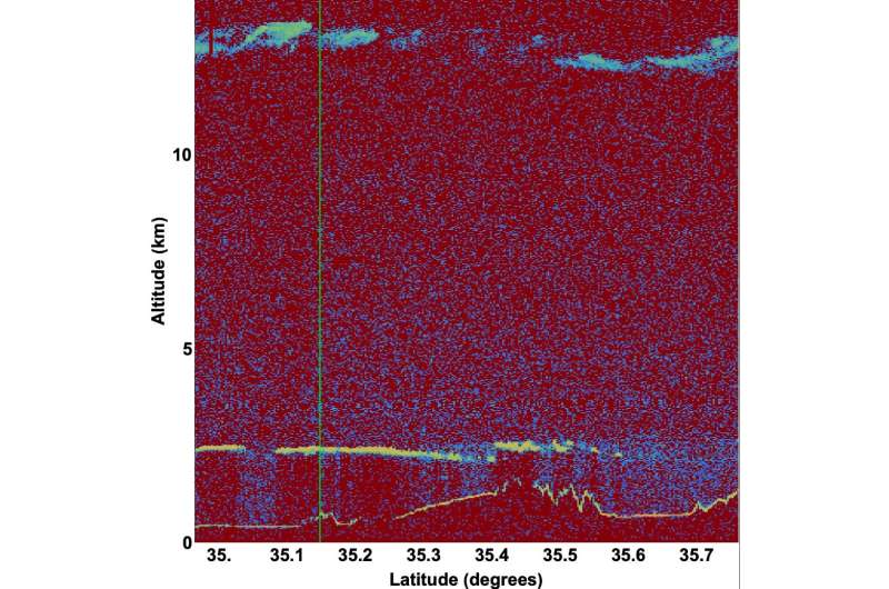


... With the precise location of the satellite in space, the location of where the beam hit, the coordinates of where Fujii's cameras were set up, and the addition of cloudy conditions, Martino was able to confirm, definitively, that the streaks of light came from ICESat-2's laser.
“There are three classes of people: those who see. Those who see when they are shown. Those who do not see.” ― anonymous

Insensible before the wave so soon released by callous fate. Affected most, they understand the least, and understanding, when it comes, invariably arrives too late