Support the Arctic Sea Ice Forum and Blog

Author Topic: Hurricane Season 2019  (Read 156166 times)

vox_mundi

  • Multi-year ice
  • Posts: 10249
    • View Profile
  • Liked: 3520
  • Likes Given: 755
Re: Hurricane Season 2019
« Reply #200 on: August 14, 2019, 06:01:44 PM »
Flooded Mississippi a Threat as Hurricane Season Heats Up
https://phys.org/news/2019-08-mississippi-threat-hurricane-season.html

The river that drains much of the flood-soaked United States is still running far higher than normal, menacing New Orleans in multiple ways just as the hurricane season intensifies.

For months now, a massive volume of water has been pushing against the levees keeping a city mostly below sea level from being inundated. The Mississippi River has run past New Orleans at more than 11 feet (3.4 meters) above sea level for more than 200 days.

... Experts who study flowing water say there's a risk the river could rise above the tops of some levees in the New Orleans area, if a hurricane pushes enough storm surge up the swollen river. The city's levees held the river back in the great flood of 1927 and haven't been topped since then, Boyett said.

The levees range in height from 20 to 25 feet (6 to 7.5 meters). While river levels are finally falling, the National Weather Service projects the Mississippi will remain well above average at about 11 feet (3.4 meters) above sea-level at New Orleans this week as hurricane season heats up.

... When Katrina formed as a tropical storm in the Bahamas on Aug. 24, 2005, the river stage in New Orleans was just 2.44 feet (0.74 meters) above sea level. It rose to 3.6 feet (1.1 meters) the day before Katrina devastated the city in 2005.

Katrina knocked out an automatic station that would have measured peak surge at the river's mouth, but an analysis by the Federal Emergency Management Agency indicates the surge reached nearly 28 feet at Pass Christian, Mississippi. Surge pushed the Mississippi River up to 11.6 feet (3.5 meters) at New Orleans—not a threatening height with the river low. But surge from the brackish lakes to the city's north and east reached 19 feet, overtopping or breaching those levees and flooding 80 percent of the city with water as much as 20 feet deep in places

--------------------------

The there's the Brown ocean effect ...

One source of the brown ocean effect has been identified as the large amount of latent heat that can be released from extremely wet soils. Mississippi and Louisiana are still pretty saturated.
“There are three classes of people: those who see. Those who see when they are shown. Those who do not see.” ― anonymous

Insensible before the wave so soon released by callous fate. Affected most, they understand the least, and understanding, when it comes, invariably arrives too late

vox_mundi

  • Multi-year ice
  • Posts: 10249
    • View Profile
  • Liked: 3520
  • Likes Given: 755
Re: Hurricane Season 2019
« Reply #201 on: August 22, 2019, 01:37:57 AM »
`Back-Loaded' Hurricane Season Bearing Down on U.S. Coast
https://www.bloomberg.com/news/articles/2019-08-14/-back-loaded-hurricane-season-bearing-down-on-u-s-coastlines

- Next six weeks could see a train of Atlantic storms develop
- Factors that have hindered hurricane since June 1 are now gone


... the next six weeks -- “the season within a season” -- is regularly the most dangerous and active time for storms to develop in the Atlantic, said Dennis Feltgen, spokesman for the National Hurricane Center in Miami.

Only two named storms have developed in the Atlantic so far this year. Dry, dusty air from Africa’s Sahara robbed potential storms of moisture, and wind shear spurred by the El Nino climate systems ripped apart budding storms. Now, those brakes on hurricane development are gone.

The result: “A big change in the pattern over the Atlantic, going from a very lackluster quiet weather pattern to a much more active one,” said Dan Kottlowski, the lead hurricane forecaster at AccuWeather Inc. in State College, Pennsylvania. “We are thinking this season will be back-loaded.”

At risk is $17 trillion in U.S. real estate along the coasts, as well as some of America’s most valuable commodities. More than 45% of U.S. refining capacity and 51% of gas processing is along the Gulf of Mexico coastline. Florida is the world’s second-largest producer of orange juice after Brazil.

There are two other factors that could spur on storms in September, according to Bob Henson, a meteorologist with Weather Underground.

The first is the so-called Madden-Julian Oscillation, a ripple of rising and sinking air that swirls through the atmosphere about every 45 to 60 days that can spark typhoons and hurricanes when combined with other factors. It could affect the Atlantic in late August or September, Henson said.

The second is a fast-moving atmospheric system known as a “convectively-coupled kelvin wave” that’s affected by the earth’s rotation. When one runs into a tropical wave moving off Africa, it can give it a speedy boost to swirl into a hurricane or tropical storm. There is one now moving across the Pacific on its way to the Atlantic, Henson said.

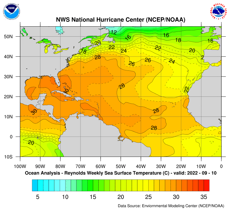
There is a deep pool of warm water tucked into the Gulf of Mexico, across the western Caribbean and along the U.S. Southeast coastline, according to Jim Rouiller, chief meteorologist at the Energy Weather Group outside Philadelphia. Any storm that reaches those areas could explode in power, he said.

“This is high-octane fuel that is all waiting in the wings for the first storm,” Rouiller said. “This is all untapped, and it will really intensify storms.”
“There are three classes of people: those who see. Those who see when they are shown. Those who do not see.” ― anonymous

Insensible before the wave so soon released by callous fate. Affected most, they understand the least, and understanding, when it comes, invariably arrives too late

nanning

  • Nilas ice
  • Posts: 2487
  • 0Kg CO₂, 37 KWh/wk,125L H₂O/wk, No offspring
    • View Profile
  • Liked: 273
  • Likes Given: 23170
Re: Hurricane Season 2019
« Reply #202 on: August 22, 2019, 05:33:44 AM »
Thanks vox-mundi.

Quote
At risk is $17 trillion in U.S. real estate along the coasts, as well as some of America’s most valuable commodities.

People?
"It is preoccupation with possessions, more than anything else, that prevents us from living freely and nobly" - Bertrand Russell
"It is preoccupation with what other people from your groups think of you, that prevents you from living freely and nobly" - Nanning
Why do you keep accumulating stuff?

TerryM

  • First-year ice
  • Posts: 6002
    • View Profile
  • Liked: 893
  • Likes Given: 5
Re: Hurricane Season 2019
« Reply #203 on: August 22, 2019, 08:26:36 AM »
Thanks vox-mundi.

Quote
At risk is $17 trillion in U.S. real estate along the coasts, as well as some of America’s most valuable commodities.

People?


Commoditized, we've been Commoditized !!!
Terry


kassy

  • Moderator
  • First-year ice
  • Posts: 8344
    • View Profile
  • Liked: 2053
  • Likes Given: 1990
Re: Hurricane Season 2019
« Reply #204 on: August 22, 2019, 03:18:55 PM »
People can evacuate so theoretically they are safe.
Þetta minnismerki er til vitnis um að við vitum hvað er að gerast og hvað þarf að gera. Aðeins þú veist hvort við gerðum eitthvað.

bligh8

  • Frazil ice
  • Posts: 313
    • View Profile
  • Liked: 56
  • Likes Given: 4
Re: Hurricane Season 2019
« Reply #205 on: August 22, 2019, 03:56:45 PM »
Hi Kassy .. Not everyone can evacuate, only 22% of folks living in Manhattan have private transportation and 52% of folks living in NYC have private transportation.  Some of the poorer folks in NYC have lived there for generations, meaning Aunt Jenny lives right down the block, so… nowhere to go. Now, I'm referring to Hurricane Sandy which did flood lower Manhattan and much of the five boroughs.  Some if not many of the corner bodegas ran out of food within several days, life became marginalized for many and all of this was with a 13ft storm surge.   

kassy

  • Moderator
  • First-year ice
  • Posts: 8344
    • View Profile
  • Liked: 2053
  • Likes Given: 1990
Re: Hurricane Season 2019
« Reply #206 on: August 22, 2019, 04:08:42 PM »
Hi bligh8, i know that is why i said theoretically.  ;)

 
Þetta minnismerki er til vitnis um að við vitum hvað er að gerast og hvað þarf að gera. Aðeins þú veist hvort við gerðum eitthvað.

vox_mundi

  • Multi-year ice
  • Posts: 10249
    • View Profile
  • Liked: 3520
  • Likes Given: 755
Re: Hurricane Season 2019
« Reply #207 on: August 22, 2019, 04:25:57 PM »
I once had a conversation with a retired FEMA coordinator regarding evacuation plans for a natural disaster in the tri-state area (New Jersey, New York, and Connecticut). Between them there are over 20-23 Million people within 50 miles (80 km) of the coast.  ... Evacuation is not an option.

“There are three classes of people: those who see. Those who see when they are shown. Those who do not see.” ― anonymous

Insensible before the wave so soon released by callous fate. Affected most, they understand the least, and understanding, when it comes, invariably arrives too late

Tor Bejnar

  • Young ice
  • Posts: 4606
    • View Profile
  • Liked: 879
  • Likes Given: 826
Re: Hurricane Season 2019
« Reply #208 on: August 22, 2019, 07:28:52 PM »
I lived in NYC (Manhattan) for a year and once met a 20-something fellow who said he'd been to Brooklyn once, but he didn't see any reason to ever leave Manhattan again.
Arctic ice is healthy for children and other living things because "we cannot negotiate with the melting point of ice"

vox_mundi

  • Multi-year ice
  • Posts: 10249
    • View Profile
  • Liked: 3520
  • Likes Given: 755
Re: Hurricane Season 2019
« Reply #209 on: August 24, 2019, 04:52:16 PM »
The tropics are starting to sizzle with tropical formation likely off the US coast this weekend
https://www.nhc.noaa.gov/gtwo.php?basin=atlc&fdays=2


“There are three classes of people: those who see. Those who see when they are shown. Those who do not see.” ― anonymous

Insensible before the wave so soon released by callous fate. Affected most, they understand the least, and understanding, when it comes, invariably arrives too late

bligh8

  • Frazil ice
  • Posts: 313
    • View Profile
  • Liked: 56
  • Likes Given: 4
Re: Hurricane Season 2019
« Reply #210 on: August 24, 2019, 05:29:52 PM »
Thx Vox

Hurricanes are a capricious thing, but still ..  I don't like the looks of this

Klondike Kat

  • Grease ice
  • Posts: 842
    • View Profile
  • Liked: 40
  • Likes Given: 56
Re: Hurricane Season 2019
« Reply #211 on: August 24, 2019, 06:02:52 PM »
Water temps ahead of the storm and low upper atmosphere wind shear favor development.  However, the mid-level air is dry, so the forecast is less certain, especially with such a small, poorly defined system.

vox_mundi

  • Multi-year ice
  • Posts: 10249
    • View Profile
  • Liked: 3520
  • Likes Given: 755
Re: Hurricane Season 2019
« Reply #212 on: August 25, 2019, 12:56:02 AM »
It has a name now ...

Tropical Storm Dorian Forms; Forecast to Reach Lesser Antilles Tuesday
https://weather.com/amp/storms/hurricane/news/2019-08-24-tropical-storm-dorian-hurricane-caribbean.html

“There are three classes of people: those who see. Those who see when they are shown. Those who do not see.” ― anonymous

Insensible before the wave so soon released by callous fate. Affected most, they understand the least, and understanding, when it comes, invariably arrives too late

Archimid

  • Young ice
  • Posts: 3511
    • View Profile
  • Liked: 899
  • Likes Given: 206
Re: Hurricane Season 2019
« Reply #213 on: August 26, 2019, 12:54:43 AM »
From the looks of it, this hurricane goes south. I'l be lucky to get rain out of this. More likely an intolerably hot day.  I gladly take a hot day over even a small hurricane like this although some tropical storm rain would be welcomed by my mango.


The shopping centers are busy with people making provisions. There is no panic. Only ordered preparation. I love it. September is the months for hurricanes, so a nice early little scare is great. The people are getting ready. However, the government is too busy playing musical chairs to help organize hurricane preparation like the northern folk prepare for winter.
I am an energy reservoir seemingly intent on lowering entropy for self preservation.

Sigmetnow

  • Multi-year ice
  • Posts: 25922
    • View Profile
  • Liked: 1160
  • Likes Given: 430
Re: Hurricane Season 2019
« Reply #214 on: August 26, 2019, 01:56:44 PM »
I’ll just leave this here....

Here's Why We Cannot Just 'Nuke' Hurricanes
https://www.forbes.com/sites/marshallshepherd/2019/05/13/heres-why-we-cannot-just-nuke-hurricanes/
People who say it cannot be done should not interrupt those who are doing it.

Klondike Kat

  • Grease ice
  • Posts: 842
    • View Profile
  • Liked: 40
  • Likes Given: 56
Re: Hurricane Season 2019
« Reply #215 on: August 26, 2019, 03:20:53 PM »
From the looks of it, this hurricane goes south. I'l be lucky to get rain out of this. More likely an intolerably hot day.  I gladly take a hot day over even a small hurricane like this although some tropical storm rain would be welcomed by my mango.


The shopping centers are busy with people making provisions. There is no panic. Only ordered preparation. I love it. September is the months for hurricanes, so a nice early little scare is great. The people are getting ready. However, the government is too busy playing musical chairs to help organize hurricane preparation like the northern folk prepare for winter.

The latest has the storm tracking a little further north - and closer to Puerto Rico.  Still quite a bit of uncertainty with this storm, but it is forecast to just reach hurricane strength.  Rainfall is not forecast to be excessive.

Sigmetnow

  • Multi-year ice
  • Posts: 25922
    • View Profile
  • Liked: 1160
  • Likes Given: 430
Re: Hurricane Season 2019
« Reply #216 on: August 26, 2019, 03:40:47 PM »
Dorian, and ??

Tropical Storm Dorian up to 60 mph, forecast tracks target Florida - Orlando Sentinel
Quote
In its “key messages” about the storm, the hurricane center said, “Dorian is expected to bring tropical storm conditions to portions of the Lesser Antilles, where tropical storm watches and warnings are in effect. Residents in these areas should refer to advice from local government officials and products from their local meteorological service for additional information.”

Forecasters also said the storm is likely to bring 2-4 inches of rain — with isolated amounts as high as 6 inches — across portions of the Lesser Antilles.

Quote
Meanwhile, forecasters are still watching a low pressure system off the coast of Florida that is expected to move farther into the Atlantic away from the state and has a 80% chance of becoming a tropical depression in the next two days, 80% in the next five days.

“Interests along the coasts of South and North Carolina should continue to monitor the progress of this system,” forecasters said. “An Air Force Reserve Hurricane Hunter aircraft is scheduled to investigate the system on Monday, if necessary.”
https://www.orlandosentinel.com/weather/hurricane/os-ne-tropical-storm-dorian-update-20190825-koiaunm2zfcajj527oupyj6dyu-story.html
People who say it cannot be done should not interrupt those who are doing it.

DrTskoul

  • Nilas ice
  • Posts: 1455
    • View Profile
  • Liked: 210
  • Likes Given: 60
Re: Hurricane Season 2019
« Reply #217 on: August 26, 2019, 05:48:04 PM »
Next at a coast near you...

Trump Reportedly Discussed Nuking Hurricanes Headed To The United States

Quote
Axios reported Sunday that President Donald Trump suggested “multiple times” that Homeland and national security officials explore using nuclear bombs to stop hurricanes from striking the United States.

During one hurricane briefing at the White House, Trump responded: “I got it. Why don’t we nuke them?” according to an unnamed source who was present, Axios reported. “We drop a bomb inside the eye of the hurricane and it disrupts it. Why can’t we do that?”


Klondike Kat

  • Grease ice
  • Posts: 842
    • View Profile
  • Liked: 40
  • Likes Given: 56
Re: Hurricane Season 2019
« Reply #218 on: August 26, 2019, 06:21:21 PM »
Slim Pickens rides again!

vox_mundi

  • Multi-year ice
  • Posts: 10249
    • View Profile
  • Liked: 3520
  • Likes Given: 755
Re: Hurricane Season 2019
« Reply #219 on: August 26, 2019, 06:27:40 PM »
Is He F*ck'n Crazy! ... (Sorry, rhetorical question - answer already known)


NOAA FAQ: Subject: C5c) Why don't we try to destroy tropical cyclones by nuking them ?
https://www.aoml.noaa.gov/hrd/tcfaq/C5c.html

As NOAA says, among the many reasons nuking a hurricane would be unlikely to make any difference at all is the sheer amount of energy contained inside of a storm: “The heat release is equivalent to a 10-megaton nuclear bomb exploding every 20 minutes,” that is, a hurricane is already releasing energy roughly equivalent to three Hiroshima- or Nagasaki-sized bombs every hour. Moreover, downgrading a catastrophic Category 5 storm to a merely strong Category 2 would require, by NOAA’s calculations, moving half-a-billion tons of air.

... As the understanding that the problem of radiation was not “merely one of detail” grew, strict parameters grew up around the atmospheric testing of nuclear weapons. Soon, ideas like that which Trump has evidently suggested were cast to the fringes of scientific thinking; Trump’s idea would actually now be prohibited under international law by the Peaceful Nuclear Explosions Treaty.
“There are three classes of people: those who see. Those who see when they are shown. Those who do not see.” ― anonymous

Insensible before the wave so soon released by callous fate. Affected most, they understand the least, and understanding, when it comes, invariably arrives too late

Aluminium

  • Nilas ice
  • Posts: 1463
    • View Profile
  • Liked: 1140
  • Likes Given: 680
Re: Hurricane Season 2019
« Reply #220 on: August 26, 2019, 07:42:09 PM »
As NOAA says, among the many reasons nuking a hurricane would be unlikely to make any difference at all is the sheer amount of energy contained inside of a storm: “The heat release is equivalent to a 10-megaton nuclear bomb exploding every 20 minutes,”
Energy of nuclear bomb theoretically unlimited. 50 Mt was reached. It's easy to say that hurricanes are too big to change. But what if bomb is big too?

kassy

  • Moderator
  • First-year ice
  • Posts: 8344
    • View Profile
  • Liked: 2053
  • Likes Given: 1990
Re: Hurricane Season 2019
« Reply #221 on: August 26, 2019, 07:58:38 PM »
Here is the resume for your friendly 50 MT+ bomb desiring a place in the lightweight division:
https://en.wikipedia.org/wiki/Tsar_Bomba
Þetta minnismerki er til vitnis um að við vitum hvað er að gerast og hvað þarf að gera. Aðeins þú veist hvort við gerðum eitthvað.

vox_mundi

  • Multi-year ice
  • Posts: 10249
    • View Profile
  • Liked: 3520
  • Likes Given: 755
Re: Hurricane Season 2019
« Reply #222 on: August 26, 2019, 09:13:50 PM »
As NOAA says, among the many reasons nuking a hurricane would be unlikely to make any difference at all is the sheer amount of energy contained inside of a storm: “The heat release is equivalent to a 10-megaton nuclear bomb exploding every 20 minutes,”
Energy of nuclear bomb theoretically unlimited. 50 Mt was reached. It's easy to say that hurricanes are too big to change. But what if bomb is big too?
The criteria to kill a hurricane is to remove energy - not add it.

Say you opt for the nukes. 100 Mt each. 12-20 hurricanes per season - every year.

And after you nuke em the fallout travels by tradewind to the US. Mar a Lago will be glowing in the dark.

How long do you think people downwind of this are going too start complaining?
“There are three classes of people: those who see. Those who see when they are shown. Those who do not see.” ― anonymous

Insensible before the wave so soon released by callous fate. Affected most, they understand the least, and understanding, when it comes, invariably arrives too late

bbr2314

  • Nilas ice
  • Posts: 1817
    • View Profile
  • Liked: 158
  • Likes Given: 53
Re: Hurricane Season 2019
« Reply #223 on: August 26, 2019, 09:15:22 PM »
As NOAA says, among the many reasons nuking a hurricane would be unlikely to make any difference at all is the sheer amount of energy contained inside of a storm: “The heat release is equivalent to a 10-megaton nuclear bomb exploding every 20 minutes,”
Energy of nuclear bomb theoretically unlimited. 50 Mt was reached. It's easy to say that hurricanes are too big to change. But what if bomb is big too?
The criteria to kill a hurricane is to remove energy - not add it.

Say you opt for the nukes. 100 Mt each. 12-20 hurricanes per season - every year.

And after you nuke em the fallout travels by tradewind to the US. Mar a Lago will be glowing in the dark.

How long do you think people downwind of this are going too start complaining?
Technically this could be good for our abundant human problem

Aluminium

  • Nilas ice
  • Posts: 1463
    • View Profile
  • Liked: 1140
  • Likes Given: 680
Re: Hurricane Season 2019
« Reply #224 on: August 26, 2019, 09:29:57 PM »
The criteria to kill a hurricane is to remove energy - not add it.
I assumed, this can increase intensity. However, I'm not sure.

blumenkraft

  • Guest
Re: Hurricane Season 2019
« Reply #225 on: August 26, 2019, 09:31:16 PM »
But what if bomb is big too?

What if the bomb is causing radioactive fallout?

Do we seriously consider even discussing that?

Everything other than making jokes about this bogus puts us in a losing position alright.

So here is the biggest joke: Donald Trump

Aluminium

  • Nilas ice
  • Posts: 1463
    • View Profile
  • Liked: 1140
  • Likes Given: 680
Re: Hurricane Season 2019
« Reply #226 on: August 26, 2019, 09:39:36 PM »
Similar event may occur without our actions and radioactive fallout.

bluice

  • Guest
Re: Hurricane Season 2019
« Reply #227 on: August 26, 2019, 09:47:19 PM »
Because hurricanes aren’t bad enough, let’s spice them up with radioactive fallout.

blumenkraft

  • Guest
Re: Hurricane Season 2019
« Reply #228 on: August 26, 2019, 09:54:40 PM »
Let's talk about Episode 1: Education


TerryM

  • First-year ice
  • Posts: 6002
    • View Profile
  • Liked: 893
  • Likes Given: 5
Re: Hurricane Season 2019
« Reply #229 on: August 26, 2019, 11:29:04 PM »
We could dig a Really Big Hole in the ground, and when the hurricane fell into it we could just cap it off!!
As a Canadian can I get a grant, from say North Carolina? to pursue this study?
Pass that joint around quick - I may be onto something that will save the world tm
Terry

Klondike Kat

  • Grease ice
  • Posts: 842
    • View Profile
  • Liked: 40
  • Likes Given: 56
Re: Hurricane Season 2019
« Reply #230 on: August 27, 2019, 06:03:49 PM »
The latest forecast for Dorian has it skirting Puerto Rico and the D.R.  The winds are expected to fall just short of hurricane strength.  The biggest threat appears to be rain, but even that seems to be six inches or less across the islands.

Sigmetnow

  • Multi-year ice
  • Posts: 25922
    • View Profile
  • Liked: 1160
  • Likes Given: 430
Re: Hurricane Season 2019
« Reply #231 on: August 27, 2019, 06:51:01 PM »
Quote
The Weather Channel (@weatherchannel)
8/27/19, 10:52 AM
#Dorian 11 a.m. update:
https://twitter.com/weatherchannel/status/1166362940091580416
Image below.
 :o
People who say it cannot be done should not interrupt those who are doing it.

Tom_Mazanec

  • Guest
Re: Hurricane Season 2019
« Reply #232 on: August 27, 2019, 08:02:21 PM »
a hurricane is already releasing energy roughly equivalent to three Hiroshima- or Nagasaki-sized bombs every hour.

Three thousand Hiroshima or Nagasaki sized bombs.

Sigmetnow

  • Multi-year ice
  • Posts: 25922
    • View Profile
  • Liked: 1160
  • Likes Given: 430
Re: Hurricane Season 2019
« Reply #233 on: August 28, 2019, 03:05:06 AM »
Quote
NOAA Satellites (@NOAASatellites) 8/27/19, 8:55 AM
#GOESEast captured this GeoColor imagery of one of the largest plumes of dust from the #SaharaDesert this year, blowing westward across the Atlantic Ocean on 8/26/2019. Interesting fact: Saharan dust can help suppress #hurricane development. More imagery: go.usa.gov/xVjHa
https://twitter.com/noaasatellites/status/1166333315579666432
Image below; gif at the link.
People who say it cannot be done should not interrupt those who are doing it.

Klondike Kat

  • Grease ice
  • Posts: 842
    • View Profile
  • Liked: 40
  • Likes Given: 56
Re: Hurricane Season 2019
« Reply #234 on: August 28, 2019, 02:21:13 PM »
Dorain has shifted eastward, and is now expected to contact the northeastern portion of Puerto Rico, and San Jaun.  Winds are still at tropical storm force and not expected to strengthen before landfall.  The greatest threat is rainfall, which could top 6".  This is a very small, compact storm, but still capable of causing local damage.

vox_mundi

  • Multi-year ice
  • Posts: 10249
    • View Profile
  • Liked: 3520
  • Likes Given: 755
Re: Hurricane Season 2019
« Reply #235 on: August 28, 2019, 02:45:20 PM »


And TS Erin
“There are three classes of people: those who see. Those who see when they are shown. Those who do not see.” ― anonymous

Insensible before the wave so soon released by callous fate. Affected most, they understand the least, and understanding, when it comes, invariably arrives too late

Klondike Kat

  • Grease ice
  • Posts: 842
    • View Profile
  • Liked: 40
  • Likes Given: 56
Re: Hurricane Season 2019
« Reply #236 on: August 28, 2019, 03:04:38 PM »
Interesting pictorial combination of the two storms.

gerontocrat

  • Multi-year ice
  • Posts: 20625
    • View Profile
  • Liked: 5308
  • Likes Given: 69
Re: Hurricane Season 2019
« Reply #237 on: August 28, 2019, 04:20:13 PM »
I guess we will see any shortfalls in fixing things after Hurricane Maria as Dorian passes through Puerto Rico.
EDIT:
NHC are saying that there will be 85 100 knot sustained winds by the time it reaches Florida

And just to make things a bit worse, the next King Tides in Florida are Aug 29th to September 3rd, and the hurricane is due to hit Florida early Monday morning 2 September.

Quote
However, once the cyclone reaches the western Atlantic well east of the Bahamas, it will encounter a favorable environment of low shear and warm waters, resulting in a more marked intensification. The NHC foreast is more aggressive than the previous one, and brings Dorian to category 3 intensity by the end of the period. This forecast very closely follows the intensity
consensus, the HCCA model, and the SHIPS guidance.

Key Messages:

1. Hurricane conditions are expected in the U.S. and British Virgin
Islands, Culebra, and Vieques today. Tropical storm conditions are
expected in Puerto Rico today with hurricane conditions possible.

2. Heavy rainfall over portions of Puerto Rico and the U.S. and
British Virgin Islands could produce flash flooding during the next
couple of days.  Heavy rains are expected to occur over portions of
the Bahamas, Florida, and elsewhere in the southeastern Untied
States later this week and into early next week.

3. The risk of dangerous storm surge and hurricane-force winds is
increasing in the central and northwestern Bahamas and along the
Florida east coast, although it is too soon to determine where these
hazards will occur. Residents in these areas should ensure that
they have their hurricane plan in place and not focus on the exact
forecast track of Dorian's center.


FORECAST POSITIONS AND MAX WINDS

INIT  28/1500Z 17.5N  64.5W   60 KT  70 MPH
 12H  29/0000Z 18.7N  65.7W   65 KT  75 MPH
 24H  29/1200Z 20.5N  67.0W   65 KT  75 MPH
 36H  30/0000Z 22.4N  68.4W   70 KT  80 MPH
 48H  30/1200Z 24.2N  69.9W   75 KT  85 MPH
 72H  31/1200Z 26.5N  74.0W   90 KT 105 MPH
 96H  01/1200Z 27.7N  77.7W  100 KT 115 MPH
120H  02/1200Z 28.6N  80.3W  100 KT 115 MPH
« Last Edit: August 28, 2019, 07:03:17 PM by gerontocrat »
"Para a Causa do Povo a Luta Continua!"
"And that's all I'm going to say about that". Forrest Gump
"Damn, I wanted to see what happened next" (Epitaph)

vox_mundi

  • Multi-year ice
  • Posts: 10249
    • View Profile
  • Liked: 3520
  • Likes Given: 755
Re: Hurricane Season 2019
« Reply #238 on: August 28, 2019, 07:22:05 PM »
Dorian is Shaping Up to Be a Major Threat to the Southeastern United States
https://arstechnica.com/science/2019/08/a-major-hurricane-may-hit-florida-late-this-weekend/

Current forecast calls for a Category 3 hurricane to hit near Kennedy Space Center.

The National Hurricane Center has ratcheted up its intensity forecast for Dorian, such that it is now predicted to come ashore as a Category 3 hurricane on Monday morning, near Kennedy Space Center on Florida's Atlantic coast.

The intensity forecast has really ramped up for a couple of reasons. First of all, the storm is no longer expected to interact with the mountainous terrain of Hispaniola. Its movement is also slower, meaning it will have several days over the very warm waters near the Bahamas, with moderate wind shear. Finally, the upper-atmosphere pattern is very favorable to intensification.


... A final landfall remains possible from north of Miami to Jacksonville. There are also questions about where the hurricane moves after it crosses the Florida peninsula. Dorian now seems more likely than not to reemerge in the Eastern Gulf of Mexico and eventually turn north, perhaps making a second landfall anywhere from the Florida Panhandle to Southeastern Louisiana.


... A final concern is heavy rainfall. The steering currents by this weekend, and into early next week, are not overly pronounced. A slower-moving storm means that some areas of the Southeastern United States—Florida, Georgia, Alabama, or the Carolinas—would see a large amount of precipitation and flooding.
“There are three classes of people: those who see. Those who see when they are shown. Those who do not see.” ― anonymous

Insensible before the wave so soon released by callous fate. Affected most, they understand the least, and understanding, when it comes, invariably arrives too late

FrostKing70

  • Frazil ice
  • Posts: 250
    • View Profile
  • Liked: 50
  • Likes Given: 14
Re: Hurricane Season 2019
« Reply #239 on: August 28, 2019, 07:29:59 PM »
Some of the models are taking Dorian to borderline Cat 4 or Cat 4 strength before it reaches Florida.   I hope the intensity stays on the lower end.

wili

  • Young ice
  • Posts: 3342
    • View Profile
  • Liked: 602
  • Likes Given: 409
Re: Hurricane Season 2019
« Reply #240 on: August 28, 2019, 07:31:58 PM »
Soooo, it's still possible that it will be a direct hit on Mara Lago, wiping it from the face of the earth? :)
"A force de chercher de bonnes raisons, on en trouve; on les dit; et après on y tient, non pas tant parce qu'elles sont bonnes que pour ne pas se démentir." Choderlos de Laclos "You struggle to come up with some valid reasons, then cling to them, not because they're good, but just to not back down."

gerontocrat

  • Multi-year ice
  • Posts: 20625
    • View Profile
  • Liked: 5308
  • Likes Given: 69
Re: Hurricane Season 2019
« Reply #241 on: August 28, 2019, 07:43:22 PM »
Soooo, it's still possible that it will be a direct hit on Mara Lago, wiping it from the face of the earth? :)
Unfortunately, at the moment looks like Dorian will landfall quite a bit North.
But we can hope. NHC says there is a 200 mile possible difference in direction in 5 days forward.
"Para a Causa do Povo a Luta Continua!"
"And that's all I'm going to say about that". Forrest Gump
"Damn, I wanted to see what happened next" (Epitaph)

KiwiGriff

  • Nilas ice
  • Posts: 1627
    • View Profile
  • Liked: 710
  • Likes Given: 380
Re: Hurricane Season 2019
« Reply #242 on: August 28, 2019, 10:12:34 PM »
Dorian looks to be a real threat .
Spring tides and Florida is  already saturated from heavy rain.
Could those who have gods please put in the word or two .
It would be salubrious if we had a landfall at.
26°40′37″N 80°02′13″W  11:04 AM EDT Sunday.
Animals can be driven crazy by placing too many in too small a pen. Homo sapiens is the only animal that voluntarily does this to himself.
Notebooks of Lazarus Long.
Robert Heinlein.

dnem

  • Grease ice
  • Posts: 709
    • View Profile
  • Liked: 319
  • Likes Given: 279
Re: Hurricane Season 2019
« Reply #243 on: August 29, 2019, 01:03:26 PM »
Well, this morning's NHC discussion says that the GFS is a north outlier and most of the other solutions are farther south, so we can still hope!!

"The models, and their ensembles,
continue to diverge after 48 hours and have not really budged from
their respective solutions compared to yesterday.  The GFS
is a northern outlier from the rest of the guidance, showing a
weaker ridge and bringing Dorian close to the Florida/Georgia
border, while the UKMET and ECMWF models show stronger ridges
and remain the southernmost solutions near South Florida."

Klondike Kat

  • Grease ice
  • Posts: 842
    • View Profile
  • Liked: 40
  • Likes Given: 56
Re: Hurricane Season 2019
« Reply #244 on: August 29, 2019, 02:06:21 PM »
Much depends on the Bermuda high.  That will determine whether the storm hits southern Florida or gets pulled further north.

gerontocrat

  • Multi-year ice
  • Posts: 20625
    • View Profile
  • Liked: 5308
  • Likes Given: 69
Re: Hurricane Season 2019
« Reply #245 on: August 29, 2019, 05:12:47 PM »
Dorian - From NHC discussion 21 - (5 knots stronger at landfall)

Quote
The new NHC track forecast is virtually unchanged from the
previous advisory, and lies very close to the multi-model consensus.
It should be noted that the ECMWF, UKMET, and HFIP corrected
consensus models remain south of the official forecast. The spread
of the deterministic models and the various ensemble guidance is
still considerable at days 4 and 5, and it is too soon to specify
where along the Florida east coast the greatest impacts could
occur.

Key Messages:

1. The risk of life-threatening storm surge and hurricane-force
winds this weekend continues to increase in the northwestern
Bahamas, and hurricane watches could be issued there tonight or
Friday.  Residents should have their hurricane plan in place and
listen to advice given by local emergency officials.

2. There is an increasing likelihood of life-threatening storm surge
along portions of the Florida east coast late this weekend or early
next week, although it is too soon to determine where the highest
storm surge will occur. Residents should have their hurricane plan
in place, know if they are in a hurricane evacuation zone, and
listen to advice given by local emergency officials.

3. The risk of devastating hurricane-force winds along the Florida
east coast and peninsula late this weekend and early next week
continues to increase, although it is too soon to determine where
the strongest winds will occur.

4. Regardless of the exact track of Dorian, heavy rains are expected
to occur over portions of the Bahamas, Florida, and elsewhere in the
southeastern United States this weekend and into the middle of next
week.


FORECAST POSITIONS AND MAX WINDS

INIT  29/1500Z 21.4N  67.2W   75 KT  85 MPH
 12H  30/0000Z 22.9N  68.1W   85 KT 100 MPH
 24H  30/1200Z 24.5N  69.6W  100 KT 115 MPH
 36H  31/0000Z 25.6N  71.4W  105 KT 120 MPH
 48H  31/1200Z 26.3N  73.4W  110 KT 125 MPH
 72H  01/1200Z 27.0N  76.9W  115 KT 130 MPH
 96H  02/1200Z 27.5N  79.8W  115 KT 130 MPH
120H  03/1200Z 28.1N  81.5W   65 KT  75 MPH...INLAND

$$
Forecaster Brown
"Para a Causa do Povo a Luta Continua!"
"And that's all I'm going to say about that". Forrest Gump
"Damn, I wanted to see what happened next" (Epitaph)

vox_mundi

  • Multi-year ice
  • Posts: 10249
    • View Profile
  • Liked: 3520
  • Likes Given: 755
Re: Hurricane Season 2019
« Reply #246 on: August 29, 2019, 06:57:43 PM »
Hurricane Dorian Forecast to Reach Florida as a Category 4 Storm on Labor Day
https://www-m.cnn.com/2019/08/29/us/dorian-forecast-thursday-wxc/index.html

Hurricane Dorian is now forecast to be a Category 4 storm -- with sustained winds of around 130 mph -- when it makes its expected landfall in the US on Monday, likely somewhere along Florida's Atlantic coast, the National Hurricane Center says.
“There are three classes of people: those who see. Those who see when they are shown. Those who do not see.” ― anonymous

Insensible before the wave so soon released by callous fate. Affected most, they understand the least, and understanding, when it comes, invariably arrives too late

rboyd

  • Nilas ice
  • Posts: 1334
    • View Profile
  • Liked: 226
  • Likes Given: 52
Re: Hurricane Season 2019
« Reply #247 on: August 29, 2019, 08:14:13 PM »
The middle of the storm track is taking it very close to West Palm Beach, with a lot of very expensive property to get hot by a Cat 4. The storm may also exit Florida into the Gulf (NOAA's forecast algorithms do not agree on whether or not a ridge keeping it south will weaken), in which case it could restrengthen and do another landfall.

wili

  • Young ice
  • Posts: 3342
    • View Profile
  • Liked: 602
  • Likes Given: 409
Re: Hurricane Season 2019
« Reply #248 on: August 29, 2019, 08:51:14 PM »
So a direct hit on Mara Lago as cat 5 is within the realm of possibility! Awesome!
"A force de chercher de bonnes raisons, on en trouve; on les dit; et après on y tient, non pas tant parce qu'elles sont bonnes que pour ne pas se démentir." Choderlos de Laclos "You struggle to come up with some valid reasons, then cling to them, not because they're good, but just to not back down."

vox_mundi

  • Multi-year ice
  • Posts: 10249
    • View Profile
  • Liked: 3520
  • Likes Given: 755
Re: Hurricane Season 2019
« Reply #249 on: August 30, 2019, 02:43:14 AM »


Predicted wind speeds (colors) and pressure (black lines) for Dorian at 11 pm EDT Sunday, September 1, 2019, from the 6Z Thursday, August 29, 2019 run of the HWRF model. This model, one of our top three performing intensity models at long ranges last year, predicted that Dorian would make landfall as a Category 4 hurricane with 140 mph winds on the central coast of Florida.


Oceanic heat content—an important factor in rapid intensification—will be greater than 75 kilojoules per square centimeter along Dorian's projected track much of Thursday, and above 50 until the hurricane reaches Florida. Such values are commonly associated with rapid intensification of hurricanes. The numbers within each icon show the hours ahead of the forecast issuance time (5 am EDT Thursday).

https://www.wunderground.com/cat6/Category-1-Hurricane-Dorian-Expected-be-Cat-4-Sunday
“There are three classes of people: those who see. Those who see when they are shown. Those who do not see.” ― anonymous

Insensible before the wave so soon released by callous fate. Affected most, they understand the least, and understanding, when it comes, invariably arrives too late