... Not sure what kind of weather pattern can cause this and what the probability is for it to remain sustained for a long period. ...
Why, we can see it alright. Quite a pattern indeed.
Day 68 is early March, and we had "positively persistent, persistently positive" AO at the time, as conviniently reported exactly in early March on
this page.
So i took a quick look and it seems we had up to some 25 km/h winds exactly "between Pole and Greenland" at day ~68, surface level:
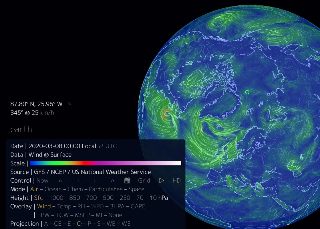
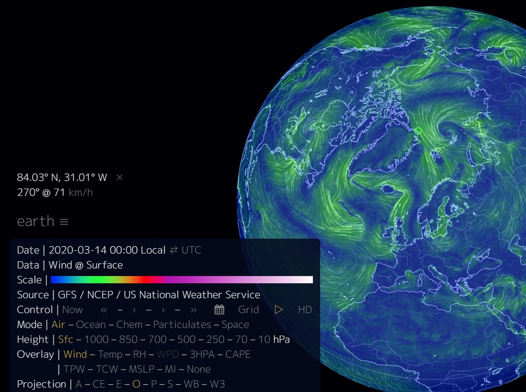
Importantly, this was very wide wind field, as you can see. Looks like ~25% of CAB ice was pushed sough and then south-east by those winds, which push mounts to huge pressure, i'd imagine, given how large area this wind was working against. Which usually doesn't do much in winter because ice holds structurally. But i think this time, it snapped under the pressure near that day 68. It'd probably still remain mostly stuck, but ~4 days later, this started (and lasted for a few days):
Given your numbers, which mean some ~0,5 km/h drift speed average for those 37 days, and given this wind speed - that drift does not surprise me the least.
I also checked same (or very close if no data for exactly March 8th is available) all the way back to 2014, and not a single year had anything similar even to 1st picture, normally it's smaller much more wavy winds much within CAB itself; and especially nothing even remotely close to the 2nd picture.
P.S. It was also then and there we had that massive ozone hole present. I read most stratospheric ozone was gone. The gas absorbs / traps IR really well, so when there is little of it and no sunlight to speak of, big temperature gradients form up. Ergo, stronger winds. Which we exactly see per above.


