Support the Arctic Sea Ice Forum and Blog

Author Topic: Tropical cyclone, Hurricane Season 2023  (Read 27710 times)

be cause

  • Nilas ice
  • Posts: 2454
    • View Profile
  • Liked: 1020
  • Likes Given: 1055
Re: Tropical cyclone, Hurricane Season 2023
« Reply #100 on: August 19, 2023, 03:29:09 PM »
Cleared the lane of debris .. the most broken branches in 5 years . 2 splits in tunnel .

And CNN just pointed out the 4 developing td's in their last news bulletin .
There is no death , the Son of God is We .

neal

  • Grease ice
  • Posts: 731
    • View Profile
  • Liked: 205
  • Likes Given: 50
Re: Tropical cyclone, Hurricane Season 2023
« Reply #101 on: August 20, 2023, 04:18:48 AM »
getting busy-moving into the basin

Jim Hunt

  • First-year ice
  • Posts: 6321
  • Don't Vote NatC or PopCon, Save Lives!
    • View Profile
    • The Arctic sea ice Great White Con
  • Liked: 901
  • Likes Given: 87
Re: Tropical cyclone, Hurricane Season 2023
« Reply #102 on: August 20, 2023, 08:44:01 PM »
TS Emily has duly formed, but is not currently forecast to cause much trouble:
"The most revolutionary thing one can do always is to proclaim loudly what is happening" - Rosa Luxemburg

Jim Hunt

  • First-year ice
  • Posts: 6321
  • Don't Vote NatC or PopCon, Save Lives!
    • View Profile
    • The Arctic sea ice Great White Con
  • Liked: 901
  • Likes Given: 87
Re: Tropical cyclone, Hurricane Season 2023
« Reply #103 on: August 21, 2023, 12:30:45 AM »
TS Franklin is looking more dangerous:
"The most revolutionary thing one can do always is to proclaim loudly what is happening" - Rosa Luxemburg

vox_mundi

  • Multi-year ice
  • Posts: 10410
    • View Profile
  • Liked: 3530
  • Likes Given: 761
Re: Tropical cyclone, Hurricane Season 2023
« Reply #104 on: August 21, 2023, 02:27:11 AM »
'Hurricane Earthquake': Magnitude-5.1 Earthquake In Ventura County Shakes Parts of Southern California
https://www.nbclosangeles.com/news/earthquakes/earthquake-hurriquake-california-la-ventura-hurricane-tropical-storm-hilary/3209652/

Several aftershocks greater than magnitude-3.0 followed earthquake near Ojai, about 80 miles northwest of Los Angeles on the same day as tropical storm Hilary hits Southern California, the first time since 1939.
“There are three classes of people: those who see. Those who see when they are shown. Those who do not see.” ― anonymous

Insensible before the wave so soon released by callous fate. Affected most, they understand the least, and understanding, when it comes, invariably arrives too late

gerontocrat

  • Multi-year ice
  • Posts: 20946
    • View Profile
  • Liked: 5319
  • Likes Given: 69
Re: Tropical cyclone, Hurricane Season 2023
« Reply #105 on: August 21, 2023, 08:24:26 PM »
I've been watching the progress of a disturbed area as it moved into the Gulf of Mexico and it is going to cause some problems.

https://www.nhc.noaa.gov/text/refresh/MIATCDAT4+shtml/211440.shtml?
Quote
000
WTNT44 KNHC 211440
TCDAT4

Potential Tropical Cyclone Nine Discussion Number   1
NWS National Hurricane Center Miami FL       AL092023
1000 AM CDT Mon Aug 21 2023

The broad area of low pressure over the central Gulf of Mexico
continues to gradually become better organized with showers and
thunderstorms increasing on the system's north side.  However,
surface observations and early morning visible satellite images
suggest that it does not have a well-defined center yet, and
therefore, does not meet the definition of a tropical cyclone at
this time.  Since the system is forecast to strengthen and make
landfall as a tropical storm on Tuesday, advisories are being
initiated on Potential Tropical Cyclone Nine with Tropical Storm
Warnings now in effect for portions of south Texas.

The disturbance is moving fairly quickly to the west at 14 kt on the
south side of a strong mid-level ridge located over the central U.S.
An even faster motion to the west or west-northwest is expected,
taking the system over southern Texas by midday Tuesday.  It should
be noted that since the system does not yet have a clear center, the
details of the track forecast are a bit uncertain.  The Air Force
Hurricane Hunters are scheduled to investigate the system this
afternoon, which should help assess the low-level structure.

The environmental factors are generally favorable for the system to
strengthen. However, there is limited time for the disturbance to
take advantage of those conditions, especially since it still lacks
a well-defined center.  The NHC official intensity forecast shows
the system reaching a peak intensity of 40 kt before landfall, which
is near the high end of the model guidance.  Rapid weakening is
expected after landfall.

KEY MESSAGES:

1. Heavy rainfall from Potential Tropical Cyclone Nine is expected
across South Texas on Tuesday and Wednesday. The heavy rainfall may
produce areas of flash and urban flooding. Across portions of
Coahilla and Nuevo Leon in Mexico, flash flooding with possible
landslides in mountainous terrain is expected Tuesday into
Wednesday.

2. Coastal flooding is possible along the south Texas coast
tonight through Tuesday morning. 

3. Tropical storm conditions are expected in the warning area and
are possible in the watch area beginning Tuesday morning.

FORECAST POSITIONS AND MAX WINDS

INIT  21/1500Z 25.0N  89.9W   25 KT  30 MPH...POTENTIAL TROP CYCLONE
 12H  22/0000Z 25.5N  92.8W   30 KT  35 MPH...TROPICAL CYCLONE
 24H  22/1200Z 26.6N  96.8W   40 KT  45 MPH
 36H  23/0000Z 27.8N 100.1W   25 KT  30 MPH...POST-TROP/REMNT LOW
 48H  23/1200Z...DISSIPATED

$$
Forecaster Cangialosi
"Para a Causa do Povo a Luta Continua!"
"And that's all I'm going to say about that". Forrest Gump
"Damn, I wanted to see what happened next" (Epitaph)

morganism

  • Nilas ice
  • Posts: 1972
    • View Profile
  • Liked: 232
  • Likes Given: 140
Re: Tropical cyclone, Hurricane Season 2023
« Reply #106 on: August 21, 2023, 11:15:55 PM »
Local forecasters in AZ and NM are suggesting that the moisture from the Gulf storm is going to slide along the edge of the heat dome, and feed into the ongoing monsoon. Good for the Colorado river basin !

FrostKing70

  • Frazil ice
  • Posts: 250
    • View Profile
  • Liked: 50
  • Likes Given: 14
Re: Tropical cyclone, Hurricane Season 2023
« Reply #107 on: August 22, 2023, 02:28:37 AM »
The forecasts I have read all indicate that this will be a rain maker, which most of Texas really needs.  They expect any negative impacts to be minimal.

FrostKing70

  • Frazil ice
  • Posts: 250
    • View Profile
  • Liked: 50
  • Likes Given: 14
Re: Tropical cyclone, Hurricane Season 2023
« Reply #108 on: August 22, 2023, 02:34:03 AM »


https://spacecityweather.com/

"It has all the ingredients you need in place to blow up into a big storm, except the most critical thing: time. The depression is racing west at 18 miles per hour, which means it will be ashore in Texas by Tuesday morning. Impacts will be minor to moderate in South Texas, with the potential for some gusty winds to tropical storm force, mainly south of Corpus Christi and offshore. Meanwhile, beneficial rain will fall in South Texas, where generally 1 to 3 inches will fall. There will likely be a few pockets of 4 to 5 inches in Brush Country and more into the mountains of Mexico."

KiwiGriff

  • Nilas ice
  • Posts: 1646
    • View Profile
  • Liked: 711
  • Likes Given: 380
Re: Tropical cyclone, Hurricane Season 2023
« Reply #109 on: August 27, 2023, 02:14:13 AM »

« Last Edit: August 27, 2023, 02:20:45 AM by KiwiGriff »
Animals can be driven crazy by placing too many in too small a pen. Homo sapiens is the only animal that voluntarily does this to himself.
Notebooks of Lazarus Long.
Robert Heinlein.

John_the_Younger

  • Frazil ice
  • Posts: 447
    • View Profile
  • Liked: 66
  • Likes Given: 139
Re: Tropical cyclone, Hurricane Season 2023
« Reply #110 on: August 27, 2023, 02:24:14 AM »
I'm 50 km from TD 10's forecast path's center line.  They never get it right, right?

KiwiGriff

  • Nilas ice
  • Posts: 1646
    • View Profile
  • Liked: 711
  • Likes Given: 380
Re: Tropical cyclone, Hurricane Season 2023
« Reply #111 on: August 27, 2023, 03:26:29 AM »
The models are as all climate models are.
Unreliable approximations of very complex physical interactions.
If I was you I would start thinking about what you plan to do in the worst possible outcome.
and keep your self updated as things progress. Due to the record ocean high heat content  in the gulf at present this thing could rapidly intensify to a storm with significant impact.   


Two good websites to keep an eyes on are.
Tropical tidbits for maps and model tracks.
 https://www.tropicaltidbits.com/

Eye on the storm blog.
https://yaleclimateconnections.org/2023/08/yucatan-disturbance-sets-its-sights-on-florida/
 For regularly updated discussions about the underlying meteorology.

If it looks more likely you will  be directly impacted to a significant degree the comments in eye on the storm often have a depth of up to date information on an actual storm you can not find anywhere else . 

FWIW
Sometimes they do get it very right.
Animals can be driven crazy by placing too many in too small a pen. Homo sapiens is the only animal that voluntarily does this to himself.
Notebooks of Lazarus Long.
Robert Heinlein.

gerontocrat

  • Multi-year ice
  • Posts: 20946
    • View Profile
  • Liked: 5319
  • Likes Given: 69
Re: Tropical cyclone, Hurricane Season 2023
« Reply #112 on: August 27, 2023, 06:46:10 AM »
TD 10 currently forecast to reach the coast of Florida on August 31 or Sept 1, i.e. at full moon. And not just an ordinary full moon. Tides are likely to be the strongest of the year, so there is a possibility of an enhanced storm surge.

https://www.space.com/16830-full-moon-calendar.html
Quote
The next full moon will be a Blue Moon on Wednesday, Aug. 30 at 9:35 p.m. EDT (0135 GMT) on Aug. 31, but the moon will still appear full the night before and after its peak to the casual stargazer. It comes after the first full moon in August, which occurred on Aug.1.

August's next full moon, will be the second full moon in a calendar month making it a 'Blue Moon'. It will also be the closest supermoon of the year.
"Para a Causa do Povo a Luta Continua!"
"And that's all I'm going to say about that". Forrest Gump
"Damn, I wanted to see what happened next" (Epitaph)

John_the_Younger

  • Frazil ice
  • Posts: 447
    • View Profile
  • Liked: 66
  • Likes Given: 139
Re: Tropical cyclone, Hurricane Season 2023
« Reply #113 on: August 27, 2023, 07:37:34 AM »
Thanks for the well known references. (I’ve been here 25 years.) I think the 5-day forecast centerline averages 500km off (at least a couple years ago it was), although it could be spot on, theoretically. At 60m elevation and 20km from the coast, storm surge is not my problem!

KiwiGriff

  • Nilas ice
  • Posts: 1646
    • View Profile
  • Liked: 711
  • Likes Given: 380
Re: Tropical cyclone, Hurricane Season 2023
« Reply #114 on: August 27, 2023, 08:36:15 AM »
Sorry  John_the_Younger I did mean any disrespect.
 The links are useful for anyone new coming across this thread and my advice was valid to anyone lurking.
The spaghetti tracks seem to be well within agreement at +- 100km.
 
   
Animals can be driven crazy by placing too many in too small a pen. Homo sapiens is the only animal that voluntarily does this to himself.
Notebooks of Lazarus Long.
Robert Heinlein.

John_the_Younger

  • Frazil ice
  • Posts: 447
    • View Profile
  • Liked: 66
  • Likes Given: 139
Re: Tropical cyclone, Hurricane Season 2023
« Reply #115 on: August 27, 2023, 06:50:29 PM »
50km from yesterday (3 day forecast) has grown to 130 km today (2 day forecast). What, me worry? [I know, sometimes they veer back.]


Jim Hunt

  • First-year ice
  • Posts: 6321
  • Don't Vote NatC or PopCon, Save Lives!
    • View Profile
    • The Arctic sea ice Great White Con
  • Liked: 901
  • Likes Given: 87
Re: Tropical cyclone, Hurricane Season 2023
« Reply #116 on: August 27, 2023, 08:12:00 PM »
TD 10 => TS Idalia

Quote
Tropical Storm Idalia Intermediate Advisory Number 4A
NWS National Hurricane Center Miami FL       AL102023
100 PM CDT Sun Aug 27 2023

...IDALIA BRINGING HEAVY RAINS TO PORTIONS OF WESTERN CUBA AND THE
YUCATAN PENINSULA...
...EXPECTED TO BECOME A HURRICANE OVER THE EASTERN GULF OF
MEXICO...
"The most revolutionary thing one can do always is to proclaim loudly what is happening" - Rosa Luxemburg

Sigmetnow

  • Multi-year ice
  • Posts: 26183
    • View Profile
  • Liked: 1166
  • Likes Given: 436
Re: Tropical cyclone, Hurricane Season 2023
« Reply #117 on: August 28, 2023, 02:02:39 AM »
NHC Storm Surge ⁦‪@NHC_Surge‬⁩
8/27 4pm CDT: There is an increasing risk of life-threatening storm surge from Tropical Storm #Idalia where a Storm Surge Watch has been issued for portions of the west coast of Florida & Florida Panhandle. Please monitor hurricanes.gov for updates to the forecast!
8/27/23, 5:16 PM. https://x.com/nhc_surge/status/1695908270509293958

⬇️ Click to enhance.
People who say it cannot be done should not interrupt those who are doing it.

vox_mundi

  • Multi-year ice
  • Posts: 10410
    • View Profile
  • Liked: 3530
  • Likes Given: 761
Re: Tropical cyclone, Hurricane Season 2023
« Reply #118 on: August 28, 2023, 02:21:13 AM »
Tropical Storm Idalia Eyes Florida, to Intensify In Record-Warm Gulf
https://www.axios.com/2023/08/26/idalia-tropical-depression-florida-threat


Threat level: The storm is forecast to intensify, potentially rapidly, over record-warm ocean waters for this time of year. Hurricane and storm surge watches have been issued for parts of the Florida coast.

In its latest advisory, the National Hurricane Center forecasts the storm to make landfall somewhere between Tampa and Tallahassee on Wednesday morning, but high winds and storm surge flooding could arrive Tuesday.

Computer models are showing the potential for the storm to reach Category 3 or 4 intensity before making landfall.
The official forecast calls for a Category 2 storm, with 100 mile-per-hour sustained winds, at landfall on Wednesday.

https://www.nhc.noaa.gov/text/refresh/MIATCDAT5+shtml/272059.shtml

Context: During the past few years, Florida has been hit with multiple storms along its Gulf Coast that have intensified at rapid rates up through landfall, a process linked in part to climate change.

Given the ocean temperatures, T.S. Idalia presents a forecasting wild card, given its expected path over historically warm waters.

Sea surface temperatures along the forecast track average close to 90°F. Notably, that ocean heat extends well beneath the ocean surface, providing a deep reservoir of heat for the storm to tap into.

https://twitter.com/WeatherProf/status/1695574418791989647?s=20

In terms of ocean heat, it doesn’t get any higher. RI will be maximized if the structure is there & the environment is supportive.

--------------------------------------

« Last Edit: August 28, 2023, 09:04:42 PM by vox_mundi »
“There are three classes of people: those who see. Those who see when they are shown. Those who do not see.” ― anonymous

Insensible before the wave so soon released by callous fate. Affected most, they understand the least, and understanding, when it comes, invariably arrives too late

neal

  • Grease ice
  • Posts: 731
    • View Profile
  • Liked: 205
  • Likes Given: 50
Re: Tropical cyclone, Hurricane Season 2023
« Reply #119 on: August 28, 2023, 02:58:17 AM »
update

neal

  • Grease ice
  • Posts: 731
    • View Profile
  • Liked: 205
  • Likes Given: 50
Re: Tropical cyclone, Hurricane Season 2023
« Reply #120 on: August 28, 2023, 03:52:28 AM »
category 2 predicted now

vox_mundi

  • Multi-year ice
  • Posts: 10410
    • View Profile
  • Liked: 3530
  • Likes Given: 761
Re: Tropical cyclone, Hurricane Season 2023
« Reply #121 on: August 28, 2023, 07:43:41 AM »
Update Cat 3

... idalia is sitting over very warm waters of about 30 degrees Celsius, and when it moves northward, it will be over the even deeper warm waters of the Loop Current in 24-36 hours.  Although the trough over the Gulf could impart some shear over the system, this is likely to be offset by upper-level diffluence.  Idalia has already strengthened more than anticipated, and the environment looks ripe for additional intensification, possibly rapid.  The NHC intensity forecast has been increased and lies at the upper bound of the guidance.  The new prediction now shows a 95-kt (110 mph)  hurricane over the eastern Gulf of Mexico at 48 hours, but it should be stressed that additional strengthening to major hurricane strength is becoming increasingly likely before Idalia reaches the Gulf coast of Florida.  Interests within the storm surge and hurricane watch areas are urged to prepare for possible significant impacts and monitor future updates to the forecast.

https://www.nhc.noaa.gov/text/refresh/MIATCDAT5+shtml/272059.shtml
« Last Edit: August 28, 2023, 08:00:51 AM by vox_mundi »
“There are three classes of people: those who see. Those who see when they are shown. Those who do not see.” ― anonymous

Insensible before the wave so soon released by callous fate. Affected most, they understand the least, and understanding, when it comes, invariably arrives too late

Jim Hunt

  • First-year ice
  • Posts: 6321
  • Don't Vote NatC or PopCon, Save Lives!
    • View Profile
    • The Arctic sea ice Great White Con
  • Liked: 901
  • Likes Given: 87
Re: Tropical cyclone, Hurricane Season 2023
« Reply #122 on: August 28, 2023, 11:52:55 AM »
The NHC's 09Z update includes a hurricane warning for Cuba:

Quote
A Hurricane Warning is in effect for...
* Pinar del Rio Cuba

A Tropical Storm Warning is in effect for...
* Yucatan Peninsula from Tulum to Rio Lagartos, including Cozumel
* Isle of Youth Cuba
* Dry Tortugas Florida

A Storm Surge Watch is in effect for...
* Chokoloskee to Indian Pass Florida, including Tampa Bay

A Hurricane Watch is in effect for...
* Englewood to Indian Pass Florida, including Tampa Bay

A Tropical Storm Watch is in effect for...
* South of Englewood to Chokoloskee Florida
* Lower Florida Keys west of the west end of the Seven Mile Bridge
"The most revolutionary thing one can do always is to proclaim loudly what is happening" - Rosa Luxemburg

gerontocrat

  • Multi-year ice
  • Posts: 20946
    • View Profile
  • Liked: 5319
  • Likes Given: 69
Re: Tropical cyclone, Hurricane Season 2023
« Reply #123 on: August 28, 2023, 12:54:45 PM »
NHC includes a warning of a potentially dangerous high storm surge. Arrival times of winds suggest that this may well coincide with the high equinoxial tides assciated with this month's Blue Supermoon.

It seems that North Atlantic Hurricanes are spawned in two ways, from a tropical wave emerging from West Africa, and from a hot spot in the Caribbean or the Gulf, Idalia being of the 2nd type.

Although Idalia has less time to strengthen, the ferociously hot SSTs and ocean temps that extend to quite a depth in the Gulf must give a much higher chance of rapid  intensification. What with AGW meaning ever higher ocean temperatures perhaps an indicator of things to come. Not that it is politically possible for De Santis to accept that.

"The Boy Stood on the Burning Deck" and cried "Fire, what fire?"
« Last Edit: August 28, 2023, 02:08:04 PM by gerontocrat »
"Para a Causa do Povo a Luta Continua!"
"And that's all I'm going to say about that". Forrest Gump
"Damn, I wanted to see what happened next" (Epitaph)

solartim27

  • Grease ice
  • Posts: 600
    • View Profile
  • Liked: 42
  • Likes Given: 75
Re: Tropical cyclone, Hurricane Season 2023
« Reply #124 on: August 28, 2023, 04:33:31 PM »
A large number of people may be impacted by human error with gas distribution. Diesel fuel was put in  gas tanks at 29 Citgo stations in the evacuation area.
https://www.washingtonpost.com/weather/2023/08/28/florida-contaminated-gas-idalia-storm/
FNORD

Sigmetnow

  • Multi-year ice
  • Posts: 26183
    • View Profile
  • Liked: 1166
  • Likes Given: 436
Re: Tropical cyclone, Hurricane Season 2023
« Reply #125 on: August 28, 2023, 05:24:25 PM »
A large number of people may be impacted by human error with gas distribution. Diesel fuel was put in  gas tanks at 29 Citgo stations in the evacuation area.
https://www.washingtonpost.com/weather/2023/08/28/florida-contaminated-gas-idalia-storm/

Quote
Fuel purchased from more than two dozen Citgo-supplied gas stations after 10 a.m. Saturday has a high chance of being contaminated….

The contamination happened after workers at Citgo, which supplies fuel to the greater Tampa area, accidentally switched diesel and gasoline in a shipment to stations on Saturday. Citgo published a list of the 29 stations believed to have received the contaminated fuel, including some as far south as Fort Myers and as far north as Brooksville.

Contaminated gasoline and diesel “have the potential of causing engine damage or affecting operability,” leading to vehicle failures, the alert said. Generators used in the case of storm-related power outages could also be affected.

Advantage: EVs.  (Expecting Tesla’s announcement of free Supercharging in the evacuation area and routes out any time now.)
People who say it cannot be done should not interrupt those who are doing it.

neal

  • Grease ice
  • Posts: 731
    • View Profile
  • Liked: 205
  • Likes Given: 50
Re: Tropical cyclone, Hurricane Season 2023
« Reply #126 on: August 28, 2023, 06:12:02 PM »
Tropical Storm Idalia is anticipated to strengthen into a Category 4 hurricane as it enters the Gulf of Mexico, Florida’s emergency chief said on Monday morning as he urged Floridians to prepare for impacts.

https://www.tampabay.com/hurricane/2023/08/28/idalia-hurricane-desantis-category-4-tropical-storm/

John_the_Younger

  • Frazil ice
  • Posts: 447
    • View Profile
  • Liked: 66
  • Likes Given: 139
Re: Tropical cyclone, Hurricane Season 2023
« Reply #127 on: August 28, 2023, 07:24:38 PM »
Although the National Hurricane Center forecasts the center of Idalia will reach the Florida coast most likely near Cedar Key, some models still have it going much closer to Tallahassee (i.e., I need to remain alert).

vox_mundi

  • Multi-year ice
  • Posts: 10410
    • View Profile
  • Liked: 3530
  • Likes Given: 761
“There are three classes of people: those who see. Those who see when they are shown. Those who do not see.” ― anonymous

Insensible before the wave so soon released by callous fate. Affected most, they understand the least, and understanding, when it comes, invariably arrives too late

Jim Hunt

  • First-year ice
  • Posts: 6321
  • Don't Vote NatC or PopCon, Save Lives!
    • View Profile
    • The Arctic sea ice Great White Con
  • Liked: 901
  • Likes Given: 87
Re: Tropical cyclone, Hurricane Season 2023
« Reply #129 on: August 29, 2023, 12:46:21 PM »
The NHC 09Z bulletin reported that Idalia is now a hurricane:
"The most revolutionary thing one can do always is to proclaim loudly what is happening" - Rosa Luxemburg

vox_mundi

  • Multi-year ice
  • Posts: 10410
    • View Profile
  • Liked: 3530
  • Likes Given: 761
Re: Tropical cyclone, Hurricane Season 2023
« Reply #130 on: August 29, 2023, 04:24:13 PM »
Hurricane Idalia Dashboard - Storm Surge/Coastal Inundation Dashboard
https://tidesandcurrents.noaa.gov/inundationdb/storm/Idalia.html

« Last Edit: August 29, 2023, 05:11:44 PM by vox_mundi »
“There are three classes of people: those who see. Those who see when they are shown. Those who do not see.” ― anonymous

Insensible before the wave so soon released by callous fate. Affected most, they understand the least, and understanding, when it comes, invariably arrives too late

Richard Rathbone

  • Nilas ice
  • Posts: 1757
    • View Profile
  • Liked: 390
  • Likes Given: 24
Re: Tropical cyclone, Hurricane Season 2023
« Reply #131 on: August 29, 2023, 05:03:23 PM »
NHC discussion on Idalia 1100 EDT

Quote
Confidence is increasing that
Idalia will reach the coast of Florida adjacent to Apalachee Bay
Wednesday morning, with all of the reliable deterministic track
models honed in on that area.

Quote
Idalia is currently over a maximum of oceanic heat content
associated with the Loop Current, and water temperatures remain
30-31 degrees Celsius along the forecast path up until landfall.
Vertical shear is also expected to be low for the next 18-24 hours,
and these conditions are expected to foster rapid intensification
before Idalia reaches the coast of Florida.  The 06 UTC runs of all
4 regional hurricane models (HAFS-A, HAFS-B, HWRF, and HMON) show
Idalia potentially reaching an intensity of 110-120 kt in 24 hours,
and as a result, the new NHC intensity forecast indicates a peak
intensity of 110 kt just before landfall.

Quote
KEY MESSAGES:

1. Catastrophic impacts from storm surge inundation of 10 to 15 feet
above ground level and destructive waves are expected somewhere
between Aucilla River and Yankeetown, Florida. Life-threatening
storm surge inundation is likely elsewhere along portions of the
Florida Gulf Coast where a Storm Surge Warning is in effect.
Residents in these areas should follow any advice or evacuation
orders given by local officials.

2. There is the potential for destructive life-threatening winds
where the core of Idalia moves onshore in the Big Bend region of
Florida, with hurricane conditions expected elsewhere in portions of
the Hurricane Warning area along the Florida Gulf Coast. Strong
winds will also spread inland across portions of northern Florida
and southern Georgia near the track of the center of Idalia where
Hurricane Warnings are in effect. Residents in these areas should be
prepared for long-duration power outages.

3. Areas of flash and urban flooding, some of which may be locally
significant, are expected across portions of the west coast of
Florida, the Florida Panhandle, and southern Georgia Tuesday into
Wednesday, spreading into portions of the eastern Carolinas
Wednesday into Thursday.

4. Heavy rainfall from Tropical Storm Idalia is expected across
portions western Cuba and may produce areas of flash and urban
flooding as well as landslides.

vox_mundi

  • Multi-year ice
  • Posts: 10410
    • View Profile
  • Liked: 3530
  • Likes Given: 761
Re: Tropical cyclone, Hurricane Season 2023
« Reply #132 on: August 29, 2023, 11:26:23 PM »
NHC Discussion 5:00 PM EDT

Idalia is moving faster toward the north, or 360/14 kt, between a mid-level trough over the northwestern Gulf of Mexico and a subtropical ridge over the Greater Antilles.  Idalia is expected to continue moving northward and turn north-northeastward as it approaches the Big Bend region of Florida during the next 12-24 hours.  There is very little spread among the track guidance, and the NHC official forecast has been placed very close to the HCCA and TVCX consensus aids during the first 24 hours.  This has resulted in a westward shift of about 20-25 n mi compared to the previous forecast, although it should be stressed that additional shifts to the track will be possible until the center reaches land.

The 12-hour intensity forecast shows a 100-kt major hurricane.  It is imperative to realize that Idalia is expected to continue strengthening beyond that time, possibly close to the 110 kt shown in the previous forecast, before the center reaches land. Weakening is expected after landfall, but due to the system's expected fast motion, it is possible that Idalia could maintain hurricane intensity as it moves across southern Georgia and approaches the coasts of Georgia and South Carolina.  After Idalia's center moves offshore over the western Atlantic, strong shear is likely to limit re-intensification, and the official forecast essentially flatlines the intensity on days 2-5.

1. Catastrophic impacts from storm surge inundation of 10 to 15 feet above ground level and destructive waves are expected somewhere between Aucilla River and Yankeetown, Florida. Life-threatening storm surge inundation is likely elsewhere along portions of the Florida Gulf Coast where a Storm Surge Warning is in effect.  Residents in these areas should follow any advice given by local officials.

2. There is the potential for destructive life-threatening winds where the core of Idalia moves onshore in the Big Bend region of Florida, with hurricane conditions expected elsewhere in portions of the Hurricane Warning area along the Florida Gulf Coast. Strong winds will also spread inland across portions of northern Florida and southern Georgia near the track of the center of Idalia where Hurricane Warnings are in effect. Residents in these areas should be prepared for long-duration power outages. Damaging hurricane-force winds are possible in portions of eastern Georgia and southeastern South Carolina where Hurricane Watches are in effect.

3. Areas of flash, urban, and moderate river flooding, with locally considerable impacts, are expected across the Florida Big Bend, central Georgia and South Carolina, through eastern North Carolina later tonight into Thursday.

https://www.nhc.noaa.gov/text/refresh/MIATCDAT5+shtml/292056.shtml

---------------------------------------------------------

Barometric pressure is beginning to drop.

-------------------------------------------------------------

Monitor for storm surge


« Last Edit: August 29, 2023, 11:45:10 PM by vox_mundi »
“There are three classes of people: those who see. Those who see when they are shown. Those who do not see.” ― anonymous

Insensible before the wave so soon released by callous fate. Affected most, they understand the least, and understanding, when it comes, invariably arrives too late

Sigmetnow

  • Multi-year ice
  • Posts: 26183
    • View Profile
  • Liked: 1166
  • Likes Given: 436
Re: Tropical cyclone, Hurricane Season 2023
« Reply #133 on: August 30, 2023, 01:18:54 AM »
NASA @NASA
Watch a live [recorded] feed from the International @Space_Station, currently flying over #HurricaneIdalia.
https://twitter.com/i/broadcasts/1DXxyvqAvYkKM
 
8/29/23, 11:28 AM. https://x.com/nasa/status/1696545262515220782
People who say it cannot be done should not interrupt those who are doing it.

Sigmetnow

  • Multi-year ice
  • Posts: 26183
    • View Profile
  • Liked: 1166
  • Likes Given: 436
Re: Tropical cyclone, Hurricane Season 2023
« Reply #134 on: August 30, 2023, 03:31:22 AM »
Idalia’s dreaded rapid intensification is becoming the norm for Gulf storms
Quote
In recent years, hurricanes Michael, Laura, Ida and Ian all saw huge leaps in intensity leading up to landfall over warmer-than-normal gulf waters.

Forecasters have warned that Hurricane Idalia, fueled by extremely warm ocean waters, could rapidly intensify over the Gulf of Mexico on Tuesday before making landfall on Florida’s Gulf Coast on Wednesday. If Idalia’s winds increase by at least 35 mph in 24 hours, the storm would become one of a growing number in recent years to have met the criteria for rapid intensification, in part because of human-caused climate change. Such storms are more difficult to predict and often cause greater destruction, complicating emergency planning and response.

In the Atlantic basin, which includes the Gulf of Mexico, 16 of the 20 hurricanes that formed during 2021 and 2022 rapidly intensified. Since 2017, seven rapidly intensifying storms have strengthened to at least a Category 4 (winds of at least 130 mph) before making landfall in the United States, together causing or contributing to at least 3,381 deaths and resulting in at least $496 billion in damage, according to reports compiled by the National Hurricane Center. Nearly 3,000 of the fatalities occurred in Puerto Rico after Hurricane Maria’s winds increased by 80 mph in one day before the storm devastated the island in September 2017.

Scientists have identified climate change as one of the factors driving the upward trend in rapidly intensifying storms, whose sudden strengthening can be hard to predict. In September 2022, for example, Hurricane Ian’s wind speed increased from 115 mph to 161 mph the day before the storm ravaged southwest Florida, catching emergency managers and residents off-guard, especially near Fort Myers, where officials were criticized for how long they took to issue evacuation orders.


Preparing for storms that suddenly strengthen
Most storms that rapidly intensify become major hurricanes of Category 3 or higher. Such storms are the most dangerous because they typically produce the strongest winds, highest storm surge and the most rain. Storms that rapidly intensify before landfall have the highest intensity forecast errors and cause the majority of deaths and damage from tropical systems, according to research led by MIT hurricane expert Kerry Emanuel.

A new study published last week came to a particularly concerning conclusion. The study found that while the annual number of tropical systems rapidly intensifying in the open ocean did not significantly increase between 1980 and 2020, the count tripled for those storms in offshore areas within 250 miles of a coastline, and thus the threat of rapid intensification in coastal regions “may continue under a future warming climate.”

Because such tropical systems “would likely make landfall within one day … these regions represent an urgent concern for operational forecast owing to the relatively short amount of time for predictions and preparedness,” the authors wrote.
https://www.washingtonpost.com/weather/2023/08/29/idalia-rapid-intensification-hurricanes-climate/
People who say it cannot be done should not interrupt those who are doing it.

KiwiGriff

  • Nilas ice
  • Posts: 1646
    • View Profile
  • Liked: 711
  • Likes Given: 380
Re: Tropical cyclone, Hurricane Season 2023
« Reply #135 on: August 30, 2023, 05:04:53 AM »
363
WTNT35 KNHC 300256
TCPAT5

BULLETIN
Hurricane Idalia Advisory Number  14
NWS National Hurricane Center Miami FL       AL102023
1100 PM EDT Tue Aug 29 2023

...IDALIA STILL STRENGTHENING...
...FORECAST TO BE AN EXTREMELY DANGEROUS CATEGORY 4 INTENSITY AT
LANDFALL...


SUMMARY OF 1100 PM EDT...0300 UTC...INFORMATION
-----------------------------------------------
LOCATION...27.7N 84.5W
ABOUT 125 MI...200 KM W OF TAMPA FLORIDA
ABOUT 185 MI...300 KM S OF TALLAHASSEE FLORIDA
MAXIMUM SUSTAINED WINDS...110 MPH...175 KM/H
PRESENT MOVEMENT...N OR 10 DEGREES AT 18 MPH...30 KM/H
MINIMUM CENTRAL PRESSURE...958 MB...28.29 INCHES
Animals can be driven crazy by placing too many in too small a pen. Homo sapiens is the only animal that voluntarily does this to himself.
Notebooks of Lazarus Long.
Robert Heinlein.

KiwiGriff

  • Nilas ice
  • Posts: 1646
    • View Profile
  • Liked: 711
  • Likes Given: 380
Re: Tropical cyclone, Hurricane Season 2023
« Reply #136 on: August 30, 2023, 05:51:29 AM »
Station 42099 - Offshore St. Petersburg, FL (144) Image indicating link to RSS feed of recent meteorological observations for station 42099
Information submitted by Scripps Institution of Oceanography
Waverider Buoy
27.349 N 84.275 W (27°20'55" N 84°16'30" W)

Wave Height (WVHT):   31.5 ft  9.6 m
https://www.ndbc.noaa.gov/station_page.php?station=42099
Animals can be driven crazy by placing too many in too small a pen. Homo sapiens is the only animal that voluntarily does this to himself.
Notebooks of Lazarus Long.
Robert Heinlein.

Bruce Steele

  • Young ice
  • Posts: 2548
    • View Profile
  • Liked: 770
  • Likes Given: 42
Re: Tropical cyclone, Hurricane Season 2023
« Reply #137 on: August 30, 2023, 06:10:01 AM »
31.5ft. at 11 seconds. Very steep ! Glad I am not there.

vox_mundi

  • Multi-year ice
  • Posts: 10410
    • View Profile
  • Liked: 3530
  • Likes Given: 761
Re: Tropical cyclone, Hurricane Season 2023
« Reply #138 on: August 30, 2023, 06:45:53 AM »
12:00 PM EDT Wed Aug 29 2023 Update

NOAA buoy 42036 recently reported sustained winds of 49 mph (79 km/h) and a gust to 60 mph (97 km/h) in the northern rainbands of Idalia

https://www.ndbc.noaa.gov/station_page.php?station=42036

Station 42036 (LLNR 855) - WEST TAMPA - 112 NM WNW of Tampa, FL

https://www.ndbc.noaa.gov/plot_wind_pres.php?station=42036&uom=E&time_diff=-5&time_label=CDT

--------------------------------------------------

1:00 AM EDT Wed Aug 30 2023 Update

NOAA buoy 42036 recently reported sustained winds of 54 mph (87 km/h) and a gust to 65 mph (105 km/h) in the northern rainbands of Idalia

Sarasota Bradenton International Airport (KSRQ) recently reported sustained winds of 37 mph (60 km/h) with a gust to 61 mph (98 km/h).
« Last Edit: August 30, 2023, 07:13:21 AM by vox_mundi »
“There are three classes of people: those who see. Those who see when they are shown. Those who do not see.” ― anonymous

Insensible before the wave so soon released by callous fate. Affected most, they understand the least, and understanding, when it comes, invariably arrives too late

KiwiGriff

  • Nilas ice
  • Posts: 1646
    • View Profile
  • Liked: 711
  • Likes Given: 380
Re: Tropical cyclone, Hurricane Season 2023
« Reply #139 on: August 30, 2023, 07:12:13 AM »
That sort of wave height on top of the predicted storm surge is going to cause major damage.
I know it is not going to be that high closer to the coast but
The wave energy causes surges in water/wave  height what we call sweepers here in NZ were background water level surges coincide with large wave trains . I have some "interesting" stories of the times when I have experienced such effects from years of recreational shore  fishing on the exposed coasts here . 
Animals can be driven crazy by placing too many in too small a pen. Homo sapiens is the only animal that voluntarily does this to himself.
Notebooks of Lazarus Long.
Robert Heinlein.

John_the_Younger

  • Frazil ice
  • Posts: 447
    • View Profile
  • Liked: 66
  • Likes Given: 139
Re: Tropical cyclone, Hurricane Season 2023
« Reply #140 on: August 30, 2023, 07:24:38 AM »
31.5ft. at 11 seconds. Very steep ! Glad I am not there.
It's getting a little too close for comfort [I'm on Tallahassee's east side], I'll tell you that!  (Oh right, I'm not supposed to worry...)  Some hurricane watchers are seeing her begin to turn - I'll take that as a good omen...

But time for bed!

KiwiGriff

  • Nilas ice
  • Posts: 1646
    • View Profile
  • Liked: 711
  • Likes Given: 380
Re: Tropical cyclone, Hurricane Season 2023
« Reply #141 on: August 30, 2023, 07:48:50 AM »
Kia Kaha  be strong – my thoughts are with you John.

 
Animals can be driven crazy by placing too many in too small a pen. Homo sapiens is the only animal that voluntarily does this to himself.
Notebooks of Lazarus Long.
Robert Heinlein.

KiwiGriff

  • Nilas ice
  • Posts: 1646
    • View Profile
  • Liked: 711
  • Likes Given: 380
Re: Tropical cyclone, Hurricane Season 2023
« Reply #142 on: August 30, 2023, 10:13:11 AM »
Animals can be driven crazy by placing too many in too small a pen. Homo sapiens is the only animal that voluntarily does this to himself.
Notebooks of Lazarus Long.
Robert Heinlein.

vox_mundi

  • Multi-year ice
  • Posts: 10410
    • View Profile
  • Liked: 3530
  • Likes Given: 761
Re: Tropical cyclone, Hurricane Season 2023
« Reply #143 on: August 30, 2023, 10:30:10 AM »
4:00 Update

Data from an Air Force Reserve Hurricane Hunter aircraft indicate that Idalia continues to rapidly intensify. The maximum sustained winds have increased to 125 mph (205 km/h) with higher gusts.

Idalia's pressure is dropping quickly. The estimated minimum pressure indicated by dropsonde data from an Air Force Reserve Hurricane Hunter aircraft is 941 mb (27.79 inches).

MAXIMUM SUSTAINED WINDS...125 MPH...205 KM/H

“This has the makings of an unprecedented event for this part of the state,” the National Weather Service in Tallahassee said. “To put this system into the historical context, there are NO major hurricanes in the historical dataset going back to 1851 that have tracked into Apalachee Bay. None.

Much of the Big Bend area – the curved coastline that connects Florida’s Panhandle to the rest of the Florida Peninsula – is forecast to see storm surge of 12 to 16 feet – the hurricane center said..

Police in Perry, a city in the Big Bend area, cautioned residents against trying to “‘ride’ this one out.”

Storm surge higher than 15 feet is “not survivable if you are caught in it,” Perry police said.

https://www.nhc.noaa.gov/text/refresh/MIATCUAT5+shtml/300800.shtml

----------------------------------------------------


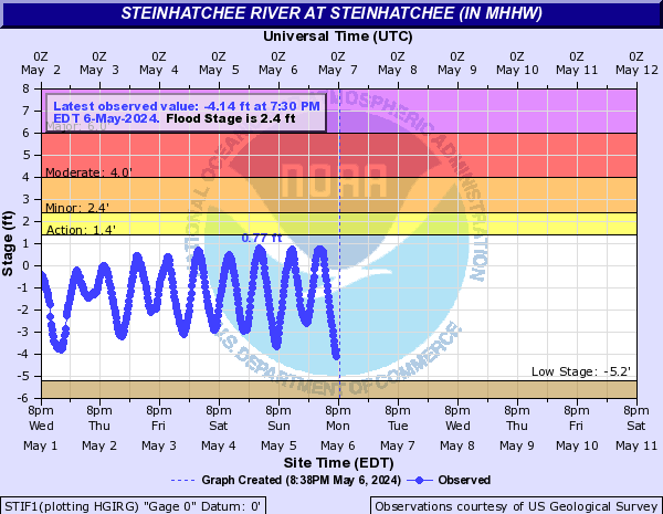
“They’re expecting some fatalities, so I don’t want to be one of them,” said Rene Hoffman, 62, of Steinhatchee, Florida, a coastal town in the area where Idalia is expected to make landfall. She owns a food stand that she lashed to her husband’s pickup truck to keep it from washing or blowing away.

“This is scary, you know, to think that water could come this high,” she said as she gathered her prescription medications and prepared to leave her home. “We’ve never had water up here before.“

The owner of a marina in Florida's gulf coast town of Steinhatchee told CNN he is choosing to stay put despite local evacuation orders.

“We’re all worried and that’s why we’re staying here -- to see if there’s anything we can do to protect what we have,” Chase Norwood, owner of Chase-N-Fish Charters at Sea Hag Marina, told CNN Tuesday night.

Norwood said the marina is his family's livelihood, leaving him determined to preserve it as much as possible.

Last year, Norwood helped with storm damage in Fort Meyers after Hurricane Ian hit the area.

“We saw stuff we didn’t know a storm could do and it was an eye-opener,” he said.

Lori Leigh Batts-Bennett has already evacuated her condo in Steinhatchee to Jacksonville, Florida and worries for those that stayed behind. Steinhatchee is about 70 miles west of Gainseville.

“Some have that mentality of ‘I’m going to stay here and take care of my own,’” Batts-Bennett told CNN. “Once people wake up they’re going to be paralyzed with what they see.”

The town does not have the infrastructure to handle these storms, Batts-Bennett explained on the brink of tears. She said she and others have started forming plans for how to help tomorrow when it’s safe, mentioning they have people with air boats on standby.

“I fear that if this is catastrophic, the people that make Steinhatchee will not be able to be in Steinhatchee because they won’t be able to rebuild,” she said.

“The landscape of Steinhatchee will be changed forever,” she added.
“There are three classes of people: those who see. Those who see when they are shown. Those who do not see.” ― anonymous

Insensible before the wave so soon released by callous fate. Affected most, they understand the least, and understanding, when it comes, invariably arrives too late

Jim Hunt

  • First-year ice
  • Posts: 6321
  • Don't Vote NatC or PopCon, Save Lives!
    • View Profile
    • The Arctic sea ice Great White Con
  • Liked: 901
  • Likes Given: 87
Re: Tropical cyclone, Hurricane Season 2023
« Reply #144 on: August 30, 2023, 12:36:04 PM »
Storm surge higher than 15 feet is “not survivable if you are caught in it,” Perry police said.

More from the NHC's 09Z update:
"The most revolutionary thing one can do always is to proclaim loudly what is happening" - Rosa Luxemburg

KiwiGriff

  • Nilas ice
  • Posts: 1646
    • View Profile
  • Liked: 711
  • Likes Given: 380
Re: Tropical cyclone, Hurricane Season 2023
« Reply #145 on: August 30, 2023, 12:52:35 PM »
Animals can be driven crazy by placing too many in too small a pen. Homo sapiens is the only animal that voluntarily does this to himself.
Notebooks of Lazarus Long.
Robert Heinlein.

Alexander555

  • Young ice
  • Posts: 2503
    • View Profile
  • Liked: 185
  • Likes Given: 49
Re: Tropical cyclone, Hurricane Season 2023
« Reply #146 on: August 30, 2023, 02:17:04 PM »

Jim Hunt

  • First-year ice
  • Posts: 6321
  • Don't Vote NatC or PopCon, Save Lives!
    • View Profile
    • The Arctic sea ice Great White Con
  • Liked: 901
  • Likes Given: 87
Re: Tropical cyclone, Hurricane Season 2023
« Reply #147 on: August 30, 2023, 05:34:40 PM »
135 000 people without power already.

A lot more than that now:
"The most revolutionary thing one can do always is to proclaim loudly what is happening" - Rosa Luxemburg

John_the_Younger

  • Frazil ice
  • Posts: 447
    • View Profile
  • Liked: 66
  • Likes Given: 139
Re: Tropical cyclone, Hurricane Season 2023
« Reply #148 on: August 30, 2023, 07:30:26 PM »
We’re fine. No power of course. I’m still COVID positive alas.

neal

  • Grease ice
  • Posts: 731
    • View Profile
  • Liked: 205
  • Likes Given: 50
Re: Tropical cyclone, Hurricane Season 2023
« Reply #149 on: August 31, 2023, 04:54:49 AM »
Idalia strengthened to a Cat 4 hurricane within 24 hours, but lost some speed from wind shear near to landfall, making landfall as a Cat 3

Rapid intensification, indeed