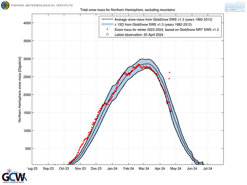
The first data point from June
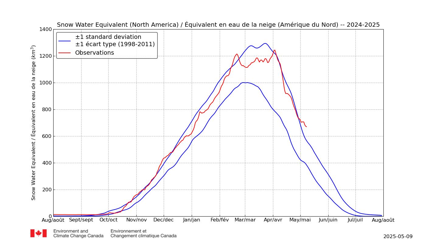
WOOF! 2X normal *without* mountain SWE!
CCIN is annoying but it is obvious looking at satellite we are still way above normal.
I think this verifies the notion that extreme spring SWE can result in a lag to the melt season (and/or its lengthening). This results in increasingly negative temperature anomalies as you head deeper into spring (and then summer), as the proportion vs normal becomes vastly more impactful when normal hits or approaches 0 and a sizable extant volume remains. I think this also results in extremely insane weather patterns as the extant albedo combines with the abysmal sea ice conditions (i.e. relatively poor-er albedo vs. norm) to generate a "flipped" 500MB pattern where blocking / continental warmth increasingly dumps into the Arctic.
I think the most surprising development this year after the gains themselves were 1) the extremely steep and rapid April NA SWE loss and 2) the extreme and prolonged plateau thereafter, which seemingly continues to-date.
Given the combination of the two factors ^, I think we are vastly under-estimating the impact of increased NHEM snowfall and its potential to mitigate absolute global warming (but aggravate net effect / damage of climate change). It is now seemingly plausible that a 1,000KM^3 melt event can help maintain limited but severe continental cooling in the weeks thereafter, constrained to the geography of the snowcover that remains as peak solar transitions toward the High Arctic.
The question is, if we have another 500KM^3 extra SWE at peak-April in another five years, does the proportion of that extra SWE that is going to melt by June *decrease* as the overall surplus increases?
As we move forward into the 2020s, if ^ is accurate, I except April and May to become increasingly wintry across parts of Eurasia/Europe and North America. June is also likely to follow for the populated belt of 40-50N by the end of the decade, if the trends re: sea ice and SWE are continued.
If we repeat 2003-2018, 2033 will have about 2,000-2,500KM^3 extra accumulated continental SWE by mid April, and North America specifically will be about double its current #s, at 3,200KM^3 vs. 1,600KM^3 seen this year.
If *doubling* early 2000s normals in Mid-April (2018) is sufficient to result in our current situation by June, quadrupling them is going to result in anomalies persisting into at least July and possibly August. Summer snow may soon become a normal event in cities like Montreal.