Dan P., hi,
I took the liberty to fit your collage in my CAD grid:
I’m not sure yet what to do. Any digitized analysis consumes a lot of time. And I haven’t even finished my “grand” Greenland ice/snowline comparison 2009-2012 yet…
It seems best to wait until refreeze has started and begin analyzing what this season figures in October. It is tempting to start from your hard “cloud-clearing” work. At first glance, there are some limitations… like the ice boundary. As you chose cloudfree app. 100x100 km blocks from differing dates, the positions get “ jittered” (if I use that A-Team term in the right way?). Also, the resolution is less than the app. 4 Mb/16,8 Mpix MODIS tiles I copy.
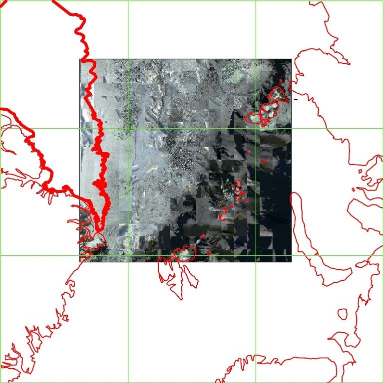
Nevertheless, on this frame you’ll see my fat red line for the “uncompromized” 28 August mesh-pack on the left. The Pole is in a low concentration zone, tentatively positioned in a rather ‘wet’ inter-floe rubble pixel. Santa has his herd of reindeer scattered over a lot of small particles!
The high concentration zone lies about 40 km into the direction of Ellesmere Island. The “mesh-pack” boundary is way further, at 225 km from the Pole.
Last year, even at minimum, it stretched some 100 km from the Pole in the direction of Siberia…
The high concentration zone , about 180 km broad, is where the mesh-pack constantly disintegrates and feeds the debris in the immense, almost 2 mkm2 measuring splinter zone.
All that is left of the once majestic MYI summer ice pack is now a mere 500 km broad swath up to Ellesmere.


